


Summer Trails Overview
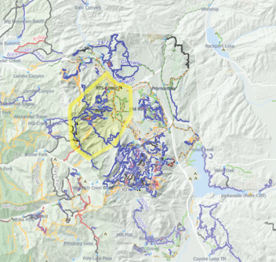
400 MILES OF SINGLETRACK
Park City trails are open to hiking/trail-running, mountain biking and equestrian trail users. Ranging in altitude from 6,500’ to nearly 10,000’, the trail system spans the whole environmental scale. In a single excursion, trail users can experience everything from high-desert covered in sagebrush, mountain mahogany and rabbit brush to the archetypal high-altitude alpine environment.
Park City has been recognized by the International Mountain Biking Association (IMBA) as the first Gold Level Ride Center in the world and continues to share that status with five other destinations. Both the Mid Mountain trail and the 26-mile, Park City Epic- Armstrong & Pinecone combined with the Wasatch Crest & Mid Mtn, are recognized as IMBA Epic rides.

June – November
The season for alpine trails typically begins in June and runs through early November. Snowpack and rate of spring melt significantly impact the accessibility of trails above 7,000’. Trail crews must wait until trails are dry before they can begin clearing winter blow-downs and making necessary, post-winter repairs. Trails in the lower-lying areas of Park City, such as Round Valley and Glenwild dry out and can be accessible up to six weeks earlier than on-mountain trails.
Weather
Utah is known for dynamic and severe weather, especially on the Wasatch Back. During summer months, temperatures can vary as much as 40 degrees in a single day. Summer storms, though typically brief, often cause sudden downpours of heavy rain/hail with temperatures plummeting 25+ degrees and are usually accompanied by lightning. Keep an eye on the sky. If thunderheads begin to develop it is wise to get off the mountain quickly.

Recommended Routes
The content in our suggested routes section is provided by Prime Cuts. Hard copies available with your Mountain Trails membership.


Hi there, I’m Rick from Mountain Trails Foundation with your weekly update
Field Manager
Follow these social media pages for the latest news and trail updates or check here each week.
Howdy Park City and valley neighbors! A quick Thursday afternoon trail update...
We had some thunder-boomers and substantial, heavy rain earlier in the day, leaving us with some uber-greasy trail conditions in most areas. Please use good judgment out there and turn around if it's sticking to heals, wheels or paws. #trailreport
Team MTF

That’s a bummer - glad I got a ride in yesterday- I was impressed with the trail conditions- rode Happy Gilmore, TM, rademan ridge, rambler to bottom of porcupine climb- all were in good shape, just a couple small areas of damp dirt… looking forward to more rides AFTER they dry out from the coming storms..
Thanks for the heads-up!
Happy Friday folks!
Friday, April 19th's grooming/trail conditions update:
Just a reminder that this is the final weekend for grooming ops up in Bonanza Flats. Transit to Trails is up and running all weekend, so book a free ride if you are interested l!
Things groomed out pretty well up in Bonanza this morning, the snow was a bit crispy on top with temps flirting with the freezing point until the sun popped up. However, not being a hard freeze, conditions started out a bit soft on the track this morning and are expected to get slushier throughout the day. Yes, classic lanes were set! Similar conditions expected for tomorrow and Sunday!
Down in the valley... The melt continues and we are playing our favorite Spring time game for the next week or two of "Is it TOO muddy? Or is it JUUUUST dry enough?". We did a good amount of trail scouting yesterday, and our Friday morning verdict is... It's still too muddy 🙁 (for the most part).
Instead of telling you about all the mud we found, here's a short list of trail suggestions there were in pretty decent shape!
1.Firstly, Id definitely suggest looking elsewhere if you want a good long ride/hike. Lots of other places are drying out faster then our Round Valley/surrounding area. So, my first suggestion would be to check out some other systems that are a lot drier then we are right!
2. Milky Way trail over at Sky Ridge- As an OUT AND BACK (all other trails in this zone still have sections of snow and mud, ESPECIALLY the Big Dipper...). About 5 miles out and back, with about 800 vertical feet of climbing/descending! It's a great early season climb and a pretty fun descent! The muddiest spot on this little ride is while you are on the Two Rocks trail directly above the parking lot, crossing the main drainage. Please navigate this 50ft section carefully (#rutssuck), then you are pretty much good to go all the way up to the start of the Big Dipper.
3. Abbreviated P-Dog loop in Round Valley- please avoid all Big Easy trail sections of this loop for now (hopefully they dry out by Sunday?). Please take the Matt's Flat Two track up to 7101 then to Porcuclimb. There is a messy spot at the top of Upper Down Dog (where it crosses Hanscom's Hollow, see pictures), but after that, it was riding pretty darn good on Thursday all the way down to the bottom! Again, please tread as lightly as possible through this sloppy spot up top and then enjoy your descent!
That's about all I can suggest right now in our neck of the woods, all other trail sections that are currently dry are pretty short and don't really connect to anything right now... So beyond enjoying two track options, the above are the longest single track rides that keep you on the trail and on your bike if you are riding.
Hopefully the sun stays out and expedites the drying process so we can stop playing this slightly frustrating spring time game!
Thanks for your patience and understanding of the current trail closures!
Whatever you get into this weekend, we hope you have a great one!
Alec & the MTF Team
#trailreport
I hear the conditions were perfect this morning. Thank you! On the other hand, I don’t understand why you aren’t grooming Bonanza until mid May or so? Especially with the trails down below still being muddy. I bet there will be 50 or so that go up tomorrow.
Thanks for the update - does anyone know how the trails in heber/kamas are ? Coyote canyon area, blue sage, unexpected journey, springer, cast, cow tummy area? This is for mountain biking - I got a new ride and am chomping at the bit to try it out
Good morning all!
Here is a quick report for, possible, our last day grooming up in bonanza.
The groom is looking good however it appears it didn’t freeze on top of the mountain last night so the snow is wet and heavy. We are looking the mid 40’s now and it’s only going to get nicer!
Not much new to report from yesterday so get out there and enjoy it while it lasts.
#trailreport
From the MTF Crew,
Matt
Are there any plans to start posting condition updates for walking, running, and biking the lower elevation trails responsibility? Keep up the amazing work!
Snow was great today! Fast with a solid base , not sticky at all! I started at about 9:15. It was still good when I left at 11:15 If that was the last day it was nice to go out on some of the fastest snow I’ve skied in a while! Nice to see all the people up there today taking advantage of the conditions. Mountain Trails that was delicious! thank you!!!
It’s another Bodacious day in Bonanza! Your grooming report for Saturday, April 13th…
Great spring conditions again this morning but the mercury is rising and we’re already in the mid-40’s at 10am.
Book your ticket to ride on T2T and enjoy!
Have a great one up there! #trailreport
Rick & Rio with assistance from ‘Roy
Huge thank you for keeping this going! Had one last great XC this morning, B-Flats by MTF is such a gift to our local community!
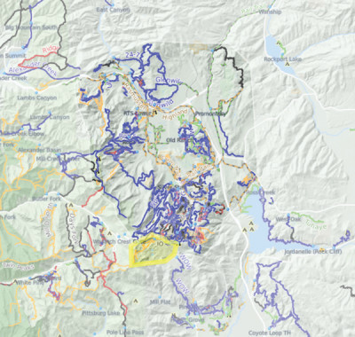
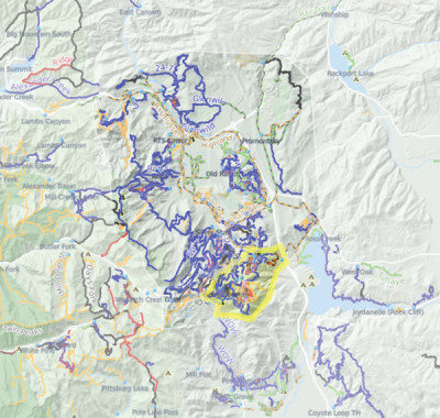
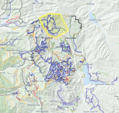
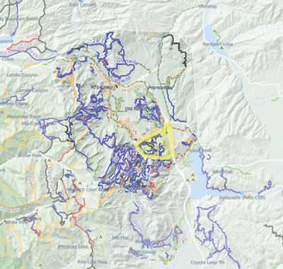
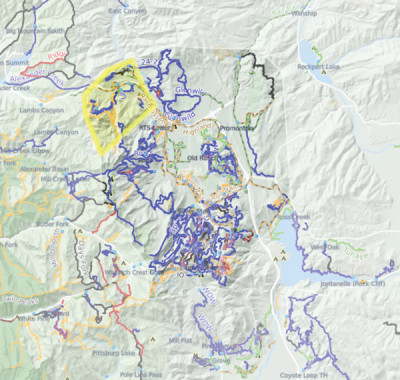
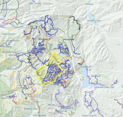
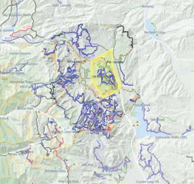
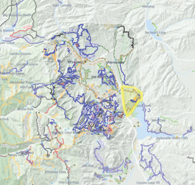
Areas
With 400 miles of singletrack in Park City, you’ll want to take a moment to get to the know the different areas before you decide where to go.
Get Trail Maps and Trail Guides
We have paper maps as well as Prime Cuts guides for sale all over town (check your local bike shop). Or you may join the MTF and select maps and guides as your membership gift. We also have a variety of interactive map products you can use for free!

Maps
The most detailed, easiest to read maps can be sent to members with a minimum donation of $30.

Prime Cuts Guide Book
Prime Cuts 3 is THE guide book to the Park City area’s hiking, biking, mining history, flora and other tips from locals. The full guide will sent to members with a minimum donation of $30.
We also have an abbreviated online version for FREE!

Interactive Maps
Our custom interactive map is available on our website year round for free. It includes suggested routes and a custom route builder.

